Thursday, January 31, 2008

Wiltshire churches notes (old blog)


Alton Barnes Church St.Mary;

taken from Pevesner;
"an Anglo saxon church, shown by the long and short quoin stones at the W end and also, by the narrow tall proportions of the nave. Recent excavtion on the north side revealed Saxon pilasters along the nave wall. Foundations of an earlier chancel were also uncovered. Impost moulding also probably A/S. Saxon chancel arch was probably taken down in 1832"
Settlement site 1.1/4 miles north from the village, on boundary with Stanton St.Bernard. Probably Iron age, comprises a roughly small circular enclosure with the remains of hut platforms within, in a charter of 905 the site was referred to as eorth byrig.


Sarsen stone under Alton Priors church
Alton Priors Church; All Saints;

"Perp.w. tower, with nave and low brick chancel, the nave was originally narrower -this is proved by the position of the norman arch............everything later Jacobean, etc.

Earliest is late norman arcades, four bays, their foundation mighty Sarsen stones.......chancel late c13 to c14 century, the tower is ashlar faced and has pinnacled battlements. Perp. aisle walls, the foundations again Sarsen stones. Pagan saxon cemetery, 1 mile ssw. Excav.in1969, 60 burials, adults and children, many well dressed and probably of the earlier 6th c. The cemetery overlies an iron age settlement.


Adam's Grave; 1 mile nne....Chambered long barrow with prominent side ditches. Part of burial chamber is exposed at the se end. The barrow, which is of classic wedge shaped is supported by a retaining wall of upright sarsens and oolitic dry stone walling(the latter now buried beneath barrow material). Excavated C18, skeletons and arrowheads found. Wodnes Berg, Wodens barrow mentioned in a Saxon land charter of Ad 825 and which gives its name to two battles fought near by in Ad 592 and 715


Looking towards Adams grave

Pewsey church was standing in 1086, when it was held by Rainbold the priest: that it was then referred to as standing on the king's estate may suggest that it was built before 940. (fn. 45) In the 13th century and until the earlier 15th the church was served by both a rector and a vicar. (fn. 46) In 1440 the vicarage was consolidated with the rectory, (fn. 47) which in 1991 was united with the united benefice of Easton and Milton Lilbourne and the rectory of Wootton Rivers as Pewsey benefice. (fn. 48) The advowson of the rectory belonged to Hyde abbey, the lord of PewseyFrom: 'Pewsey', A History of the County of Wiltshire: Volume 16: Kinwardstone Hundred (1999


Pewsey Church


REINBALD the priest holds Avebury church with two hides according to the Domesday Book,

REINBALD the priest holds Pewsey church with 1 carucate of land. Other land held by the Abbey of Winchester, also Arnulf (presumably of Hesdin) holds two hides (he could not be separated from them) Edric holds 1.l/2

Archaeological evidence of Saxon* terrace cultivation on the side of Pewsey Hill along with burial mounds know as "barrows", show that this area was settled as long ago as the 6th century CE** with possible evidence of an underlying Iron Age settlement dating as far back as c. 300 BCE**†. Evidence of post Roman culture has been found all along the Avon and Kennet river valleys with additional discovery of a Roman mosaic pavement in Manningford Bruce.
Literature from the Saxon era refers to Pewsey as "Pevisigge"or "Pev’s Island" after a local land owner named Pev. It gained its charter in 940 CE and the Parish was granted equal portions of river meadow, woodland and downland grazing land. The original charter is now preserved at Winchester College, a Public (privately run) school in Winchester

Tockenham Church
This church is not of notable interest, but the reused roman stature embedded in the wall probably came from the roman villa nearby.

"Roman tesserae, tile fragments and pottery sherds were found at Tockenham and a possible villa was suggested. The site has been subject to investigation by the Time Team in 1994 and was confirmed as being a villa with associated structures, probably dating from the 2nd to 4th centuries. Finds from the excavations have included pottery, tesserae, window glass fragments and roofing tile. Scheduled. " taken from Pastscape Monument No.887838.

"The Rod of Asclepius symbolizes the healing arts by combining the serpent, which in shedding its skin is a symbol of rebirth and fertility with the staff, a symbol of authority, befitting the god of Medicine. The snake wrapped around the staff is widely claimed to be a species of rat snake,Elaphe longissima, also known as the Aesculapian (Asclepian) snake. It is native to southeastern Europe, Asia Minor and some central European spa regions, apparently brought there by Romans for their healing properties." taken from Wikipedia.

The snake wrapped round Aesculpius's rod is a single snake and not to be confused with Mercury's double snakes..There are also wooden posts embedded in the south wall of the church - Pevesner says, that inside, the bell-turrets stand on old posts, and that they are flanked by new timber-framed work.


Monday, January 28, 2008

Poetic metaphor - the gender bias

Silbury Hill

I think Gaia was a virgin
when the men came
took their dreams out
and buried them deep inside her
Then they wandered the fields bewildered
carved circles on rocks
and built stone chambers
trying to decipher
What is this great mound?
Surely it holds such plunder?
Oh you silly men
with your measuring strings
sandals tattered and torn
Everyone knows
this mound
is just a belly full of gods
waiting to be born

Persephone Vandegrift

---------------

Silbury hill

Bones of our wild forefathers,
O forgive,
If now we pierce the chambers of your rest,
And open your dark pillows to the eye
Of the irreverent Day!
Hark, as we move,
Runs no stern whisper through the narrow vault?
Flickers no shape across our torch-light pale,
With backward beckoning arm?
No, all is still.
O that it were not!
O that sound or sign,
Vision, or legend, or the eagle glance
Of science, could call back thy history lost,
Green Pyramid of the plains, from far-ebbed Time!
O that the winds which kiss thy flowery turf
Could utter how they first beheld thee rise;
When in his toil the jealous Savage paused,
Drew deep his chest, pushed back his yellow hair,
And scanned the growing hill with reverent gaze,
-Or haply, how they gave their fitful pipe**
To join the chant prolonged o'er warriors cold
. -Or how the Druid's mystic robe they swelled;
Or from thy blackened brow on wailing wing
The solemn sacrificial ashes bore,
To strew them where now smiles the yellow corn,
Or where the peasant treads the Churchward***path.

Emmeline Fisher

A couple of months back I read a book on the Wild by an author whose names escapes me, but at the time she made a point of how we use language to describe the 'conquest' of mountains. Now this idea probably started in the late 19th and early 20th century, and probably has its roots in Imperialism. But she made striking examples of how in the literature of that time, the words used to describe ascending the mountains, had more to do with the relationship between men and women. For instance, a mountain or a wild place such as the North and South Poles has to be conquered, subdued, tamed, brought into submission, yet for a women's interpretation of these words we might see rape or violation of these places, and of course quite a few men see exactly the same today.
A parallel can obviously be drawn with Silbury, the several tunnels have the same implication of violation, giving rise to the fact that Silbury is a female, though of course in defence the 'femaleness' of the mound is a modern definition, brought on by theorising of the 'mother earth' analogy.
The Persephone Vandegrit poem illustrates this perfectly, she has taken on board the notion that Silbury is a goddess, giving birth to gods, a subtle trick of female superiority is played here 'O you silly men' messing around with their bits of strings and spiral rock art. Gaia is a 'virgin' despoiled by men. It is the intuitive response of a woman one sees in this poem, similar in fact to the rape of the virgin farmed landscape around Tara that has a motorway being constructed through it. The rape here is defined by the historical and sacred nature of the landscape round Tara, how it lies in the heart of the Irish people, caught up in poetry and myths.
Now taking Emmeline Fisher's response, that of a young girl, we see something slightly different.
She falls back on the imagery of the 19th century, Bones of our Wild forefathers, please forgive, now we are viewing the pagan druid with all that fanciful stuff that has been written about, there is no hint of our female Silbury here, only that Of science, could call back their history lost, it is a plea to stop the wrecking of an old monument that has so much history written into it. Science as we know is incapable of calling back history, it can only summarise and deduce from the little known facts that are left behind.
To return to modern day poetry and its interpretation of the femaleness that imbues Silbury, perhaps in itself there is a false trail being left here. Fecundity of nature, giving of nature, the goddess Gaia is something that has built up in the mythology of religion and belief through the last 20th century, Ronald Hutton was at pains to deny the 'mother goddess' in nature, a storytelling trick used by 20th century feminists in the battle for equality...
In all this, when addressing one's own viewpoint, either from the imagination or the practical side of our nature, we are very subjective in our approach , the heart is too easily moved in poetry - there is poetry written from the soul or there is poetry written to a particular fashion., either way we have to judge impartially.

Sunday, January 27, 2008

Notes

Reading David Field's Earthen longbarrows gives rise to some thoughts as to reasons how some things might have been viewed in neolithic age....
1) Turf; - symbolic removal of turf to cover longbarrows, could be that land that is stripped for cultivation, would have a special symbolic significance - not all land only virgin territory?
Regeneration or renewal, a setting aside of earth that is sacred, which perhaps goes back to the 'goddess' image of the earth. This can be seen at Silbury - the primary mound 'captures' in its turves, flowers and seeds to be carried into the future? (immediate covering of this small mound) or, back into the past, or a giving to the the earth. Whatever, turf is important, for it comes from many different places within the landscape.
2) Ditches can be seen as barriers to keep 'evil' spirits out but they also can be seen to keep spirits/ancestors confined to the longbarrow. Silbury has ditches with a narrow causeway to the south?, the water is a barrier, only a chosen few can walk across the causeway - similar to a stone circle.
3) Water; water represent s something - it is a mirror... it can be motionless, or in a river running towards a particular landscape. You can hear running water 'talk' but still water reflects the outer world, though in a sense drawing you into another liminal world when you look down into its depths.
Our modern world is defined by the 4 compass points N/S/E/W, yet neolithic understanding would only be aware of the circular nature of the world - the sun rising in one part and traversing its path through the sky to the other side, until it disappears.
So if the the causeway faces towards the zenith of the sun what does it signify, WKLB faces the rising east sun, and EKLB faces N/E?
So do the 'spirit/ancestors' escape from these two longbarrows, or trapped by the ditches, and the filling in of WKLB made sure there was no escape.
What are the spirits captured in Silbury then, if any, ancestors? strange beings that inhabit the landscape as seen in the strange shapes of the sarsen stones, so eloquently expressed on the Avebury stone circles.
Neolithic people ask the earth to regenerate its bounty - food, pottery, bones of animals, bones of people - rebirth? Another world to be travelled to as with the Beaker people who take their goods, - drinking mugs,weapons and jewellry with them.
Silbury has none of things - a large mound, empty of human bones?
Past, present,future; was Silbury a great undertaking to ask the earth/gods/ancestors to replenish diminishing resources - why then use up so much of the earth's resources?
What is the kernel of truth that lies buried at the heart of Silbury - not gold, not bones, not a goddess figure - but the earth itself. A miniature landscape, a mound surrounded by water from which at the top you could see all the different horizons of the downs, a place to see the'coming' of the winterbournes?
Captured spirits,seeds, land; Human bone is unimportant it is the essence, the soul...animus mundi occupying both people, animals and land, melding together they are an integral part of the fecund side of nature - no death, only all this living tissue of life coming and going through time, same animals, same humans, same plants....
Stone rivers in the landscapes; Piggledene, Fyfield Down, the field round Devil's Den, up to the 1940s was apparently covered in sarsen stones, the mound being undistinguishable...
Covering of Silbury - the layering "toblerone" effect as experienced by Atkinson.
Longbarrows round Silbury, do they represent territores, being built of the edge of land of different clans. So does Silbury pull those territories together, does she stand at a centre representing a tribal confederacy - a meeting place by the waters of the winterbournes..

Sunday, January 20, 2008

Bath's Heritage at Stake

"The tendency to pass "desirable" planning applications regardless of planning policy and guidelines appears to be nationwide, so a press release has been sent to the national dailies bringing attention to the issues.!

Latest news from Bath Heritage Watchdog

http://www.bathheritagewatchdog.org/images/wakeupbritain.pdf

HERITAGE IS 'NO BARRIER TO AREA'S DEVELOPMENT'

A bid to use Bath's international heritage status to fight off plans for new development to the south of the city looks likely to fail.Bath and North East Somerset Council had argued that housing and business developments on the southern edge of Bath could threaten its status as a World Heritage Site.But an independent panel analysing comments on a massive blueprint for the future of the South West has rejected this argument - and has also angered council chiefs by suggesting that around 3,000 extra new homes could be built around Keynsham.It has told Communities Secretary Hazel Blears that development can be allowed to the south of Bath, and that the "critical area" intended to be protected by the rare WHC status was "the compact city set in the hollow in the hills".The panel concludes: "We consider that there is some scope for development that would not threaten the special character of the city. Bath is a living city and needs to be planned accordingly. We conclude that consideration should be given to the provision of employment land on the southern edge of Bath."The panel was commenting on the South West Regional Assembly's Regional Spatial Strategy (RSS) document, which looks at the way the housing and employment needs of the region can be accommodated in the next 20 years.The panel says the RSS's estimate of the number of jobs that can be created in Bath is higher than the 8,500 suggested by B &NES Council.It adds: "We are not convinced that development on the southern edge of the city adjoining normal suburban development threatens the integrity of the historic, high density city within the hollow in the hills."It also says that just because land is in the official Cotswolds Area of Outstanding Natural Beauty zone around Bath, this should not mean it cannot be developed. The search is on for sites to the south of the city to accommodate 1,500 new homes.People in Keynsham have pledged to fight any suggestion of development that might weaken the green belt that separates Bristol and Bath.But the panel says 3,000 new homes can be accommodated in and around the town and says these can be built without blurring the distinction between the two cities.The panel also calls for better rail services between Bath and Wiltshire and says the need for action to protect Bath from the effects of through traffic must be kept under review.B &NES Council cabinet member in charge of planning Cllr Charles Gerrish (Con, Keynsham North) said he was "shocked and disappointed" at the recommendation for the town he represents.He said the council would "make the strongest possible representations" on the issue.If the panel's suggestion is taken up, the number of new homes to be built in B &NES over the next 20 years would rise from an original suggestion of 15,500 to 18,800.The panel also rejected a suggestion that the green belt should be extended in the Midsomer Norton and Radstock area.Last year, the draft RSS was examined by an independent panel appointed by Ms Blears, who invited more than 200 organisations and individuals to take part in public hearings held in Exeter.Following the publication of the RSS last week, the next stage will see the minister consider the report along with the representations which were previously submitted.Her proposed changes are expected in the spring, which will be followed by a 12-week period of consultation on any suggested amendments.The panel report can be downloaded from the website ....the rest of the article can be found at the following link...


http://tinyurl.com/2eojvp


The 'bowl of Bath City' seen from the West


Taken from Kelston Hill

Looking towards Bitton


Looking towards Keynsham and Bristol

Document as to redevelopment of 1500 houses. area of Urban extension to Bath. The Cotswold outstanding Natural Beauty


http://tinyurl.com/3a7gfw

Sunday, January 13, 2008

Saxon Avebury

All is troublesome
in this earthly kingdom,
the turn of events changes
the world under the heavens.
Here money is fleeting,
here friend is fleeting,
here man is fleeting,
here kinsman is fleeting,
all the foundation of this world
turns to waste!

taken from the Anglo Saxon "Wanderer" full text here;
http://www.anglo-saxons.net/hwaet/?do=get&type=text&id=Wdr
Here we come to the sparse written words of the saxons and their invasive presence on the scene of a probably very untranquil late British land of fortified hillforts.Burl gives the name Aureberie as first mentioned in the Domesday book, probably belonging to one of the first settlers by the earthwork "Afa's Burh" but this is of course late 1086. Early saxon settlement in the Glebe field car park west of the henge, probably a single homestead by the river, was found when a 9th century "grubenhaus" was excavated, this later developed into a rectangular enclosure, surrounding the church and regular house plots, extending westward from the west entrance of the henge towards the Winterbourne- probably late 9th/ 10th.Avebury.
Earlier settlement would have developed round the Herepath , military saxon road, and this can be traced to the west of the henge where regular plots of land are laid out perpendicular to the east/west of of this road, also in times of emergency, the henge itself would have provided good protection for stock and people. It is conjectured that Avebury was probably a "failed" town, Marlborough becoming dominant.
The church of St.James, that lies at the heart of Avebury has displaced anglo saxon sculpture,(as do so many churches in this area have); the north-west corner of the present nave is composed of side alternate megalithic quoins with a fragment of A/S sculpture of late 9th/10th century, originally part of a cross shaftor coffin lid, indicating that there was an earlier masonry church here, contemporary with the burh. The A/S chancel was discovered during restoration in 1878, it was shorter than the present one.Burl says that although the font in this church is elegantly sculptured in a much later style (Scandinavian) it would have been an early undecorated a/s font.

Likewise the english king and the prince,
Brothers triumphant in war, together
Returned to their home, the land of Wessex.
To enjoy the carnage, they left behind
The horn beaked raven with dusky plumage,
And the hungry hawk of battle, the dun coated
Eagle, who with white-tipped tail shared
The feast with the wolf, grey beast of the forest.
Never before in this island, as the books
of ancient historians tell us,
was an army put to greater slaughter by the sword..

taken from the Anglo Saxon Chronicles
---------------------------------
Three ancient roads ran through the parish, the Ridge Way, the Roman road, and Harepath Way, the path of which has been traced for 1 km. along the edge of West Down. In the 18th century the London-Bath road ran through West Kennett to Beckhampton, crossing the Kennet south-east of Silbury Hill. At Beckhampton the road forked. One branch continued northwestwards to Cherhill, the other led southwestwards, reaching Bath via Sandy Lane in Calne. Both were turnpiked in 1742. (fn. 43) The more northerly branch became the modern LondonBath road, the principal route through the parish. West of Beckhampton its path was moved slightly to the south in 1790 (fn. 44) but it had returned to its original course by 1889. (fn. 45) In the early 18th century a coach road led over the downs from Marlborough towards Avebury village. It entered the Circle from the east and apparently turned south-west across the Kennet to Beckhampton. (fn. 46) The downland route fell out of use after the London-Bath road was turnpiked (fn. 47) and was marked only by a track in 1979. In 1675 a road to Devizes left the London-Bath road near Silbury Hill. (fn. 48) In the 18th century the main route to Devizes within the parish was part of the Bath road via Sandy Lane. The road from Beckhampton to Avebury was turnpiked in 1742 and that north of Avebury in 1767 to form the SwindonDevizes road. (fn. 49) Another turnpike road linked Avebury and West Kennett. The lane leading from the London-Bath road to East Kennett was turnpiked in 1840 as part of the West Kennett to Amesbury road, one of the last roads in England to be turnpiked. (fn. 50) The bridge over the Kennet between Avebury and Beckhampton was replaced in 1950 (fn. 51) and a roundabout built at Beckhampton c. 1960. (fn. 52) Few changes occurred in the pattern of secondary roads between the late 18th century and the 20th. A path which skirted Avebury village to the north and west in the 18th century had, however, disappeared by 1979. The main street of Avebury village was linked by a footbridge with the network of lanes west of the river which connected the farms and houses of Avebury Trusloe. From a point on the old road to Marlborough some 700 m. east of the Circle, tracks radiated to Winterbourne Monkton, Chiseldon, and West Overton. In the 19th century new or improved tracks were made to South Farm on Avebury Down, Windmill Hill, and Beckhampton Penning south of Beckhampton. An older path led from Beckhampton village to Tan Hill in All Cannings. Further east a path ran from the London-Bath road at West Kennett to East Kennett across a bridge perhaps built in the late 18th century. (fn. 53) Avebury village was one of the larger settlements in Selkley. Its assessment
From: 'Parishes: Avebury', A History of the County of Wiltshire: Volume 12: Ramsbury and Selkley hundreds; the borough of Marlborough (1983), pp. 86-105.

URL:
http://www.british-history.ac.uk/report.aspx?compid=66519. Date accessed: 13 January 2008.

Tuesday, January 8, 2008

The Abdication of Belief

Those - dying then,


Knew where they went


They went to God's right hand


That hand is amputated now


And God cannot be found -


---------


The abdication of belief


Makes the Behaviour small


Better an Ignus Fatuus


Then no illume at all


___________________________________


This poem I heard last week on the radio programme"Something Understood". It is something Emily Dickinson wrote when she had a crisis of belief, therefore "The Abdication of Belief" is a familar term to describe this moment when religious people go to that dark place of the soul and question their belief. An Ignus Fatuus is similar to a small flare of light, or 'will of the wisp' that lights up for a brief second.

The youtube video below plays music by Youssou N'Dour, accompanied by Pete Gabriel, who lives down the road in Box and is famous in megalithic terms for his song - Solsbury Hill
A song was played on the programme called Red Clay, and my son downloaded the album for me this week. So much of what comes out of Africa news is miserable, and yet the music is marvellous. Africa is a land full of different countries and tribes, to always view it in terms of poverty, aids and disaster is only to present one side. It also has vitality, sun, many cultures and languages that are different to our own culture.


http://uk.youtube.com/watch?v=9ldouV5_atY&feature=related


Dedicated to the King of Bling and the Talent scout! - Ephraim and Mark, and if that one doesnt work.....


http://uk.youtube.com/watch?v=rAFU0ssYxRk


Sara and friends


Monday, January 7, 2008

Meeting with deer


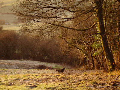
This not very good photograph taken early on Sunday morning captures a beautiful tension between me taking the picture, the dog commanded not too chase and the deer by the wood holding its ground. All captured in the warm light of the rising sun.
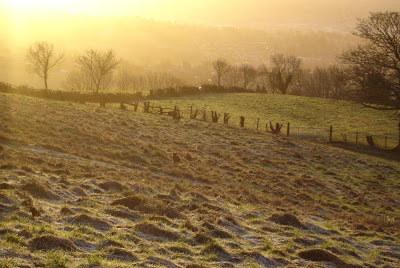
We are all three animals but our neural cells work differently, my brain is considered higher than the other two, but both the dog and the deer are also finely honed to survive in their own environment. One is wild, the other tame and therefore under authority, (the dog happy to be part of human life,) the wild deer on the other hand has no such shackles and yet is aware of both the human and dog is standing his ground - a balance of mutual understanding is achieved.The deer won the day and moved off into the woods but this earlier photograph shows Moss chasing a second deer, albeit slowly because he did'nt want to catch up with it.


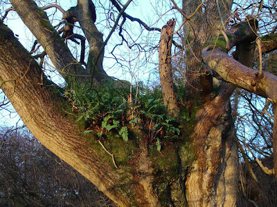
A different relationship exists between the ferns and the trees. The breakdown of the bark of the tree has allowed the ferns to grow in this damp cool environment, a fragile ecosystem that may have been threatened by the removal of old thorn bushes in front of the tree.

Sunday, January 6, 2008

The Skinner Diaries

The Reverend Skinner left three large iron bound chests to the British Museum of diaries many of which are valuable records of the drawings and excavations he made during his life. It is calculated that they run to 25000 pages, half of which relate to his native Somerset.
There is an ongoing project to publish some of his drawings in CD format - Cornwall, Devon, Hadrian Wall or the Wansdyke which will be listed by the British Library. This will enable researchers to access sets of specific localities. It is a long process and his pen and ink drawings are often very naive but also of course very informative.

ref; CBA for South West England.

One further note;
The Reverend William Lisle Bowles of Bremhill, apart from writing poetry, wrote The Parochial History of Bremhill, and also either published a separate pamphlet on the Stupendous Monuments of Antiquity in the Neighbourhood of Avebury, Silbury and Wansdike, or that these illustrations appeared in his Parochial History. One book appears to be in the local library Service.