“This valley bounds North-East Yorkshire on the south and separates it from the
Chalk Wolds of the East Riding. More or less enclosed by higher land, it is a low lying
basin, the average altitude of its almost flat floor being less than one hundred
feet above sea level. Its length from east to west is about thirty miles, and its width
from north to south varies from five to ten miles. The Limestone Hills overlook it
on the north; the Howardian Hills on the south-west; and the Chalk Wolds on the
south. The Vale narrows toward the east where it debouches on to the coast at
Filey Bay. In the west, the narrow Coxwold-Gilling gap, about fives miles long by one
mile wide, links it to the Vale of York or Mowbray."
(F. Elgee, 1930. 3)
“When I went to school I learned that the Vale in which we lived had once been a
lake, but long ago the sea had eaten through the hills in the east and so released the
fresh waters, leaving a fertile plain. But such an idea would have seemed strange to
my innocent mind… I seemed to live, therefore, in a basin wide and shallow like the
milkpans in the dairy; but the even bed of it was checkered with pastures and
cornfields, and the rims were the soft blues and purples of the moorlands”
(Read, 1933, The Innocent Eye).
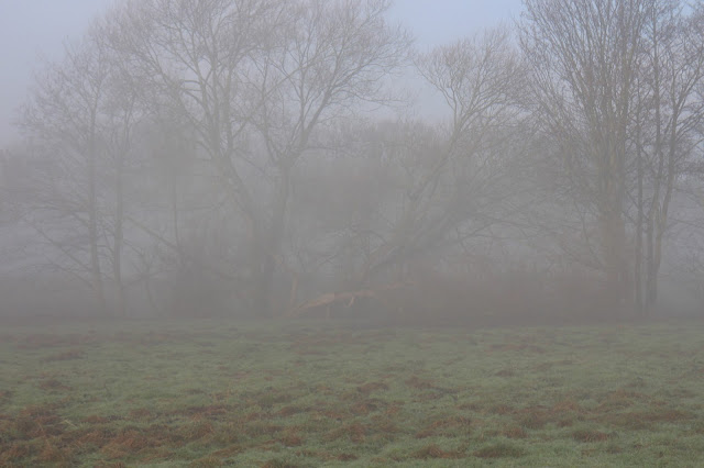
I was going to start with photos of the foggy mist we have had encountered over the last few days, there are already dire warnings over the radio about the fog down south and here in Yorkshire. But then I got thinking, really we have mists and fog round here because it is the Vale of Pickering, once upon a time a lake, home to the famous mesolithic Starr Carr settlement. The Vale is surrounded by hills and the land is drained by many rivers, except the Derwent which at one point reversed its flow. See Note below...
 |
| She met an Irish water spaniel yesterday, not impressed. |
You will see that our walk takes us along a bank, this is the protecting buffer against the river flooding onto the fields. This bank is on either side of our river Seven, the other side stops the river from flooding the village. The river people have just finished shoring up the banks of the river just along here which are deeply shelving. The river rises on Rosedale moor, one day I shall go and try and find it's place of beginning.
One of the links below in the Statements of Significance of the Land has the archaeologist referring to the ritual significance of its watery landscape, giving a 'sacred' meaning to the Vale, the backward flowing river Derwent being one such phenomena - mmm. Could this be the 'Land of Deira' the Dark Age kingdom next to Bernicia, not sure, but the story of the Christian princess from Kent coming up to marry the king and converting him could well give rise to the early establishment of the Saxon churches round here, somewhere it states that nearly every settlement you see in the Vale has a probable Saxon beginning.
Notes;
"Patterns of landscape significance continue through time with an excavated complex
at West Heslerton, which is articulated in its final form as a Roman shrine, associated
with both a well and spring. Though the earliest phases were unexcavated the
assumption is that there was an earlier prehistoric use. An increasing number of
Roman ritual sites within the Vale of Pickering seems to confirm that the Vale was
sacred from early prehistory, perhaps on account on the ‘backward’ flowing river
From the 8th century the Vale of Pickering is associated with the people of Deira,
and may have formed its heartland, as the Vale has the highest density of early
churches in the UK. There are a remarkable number of 7th and 8th century religious
communities found on the borders and approaches of the Vale of Pickering (at
Lastingham, Gilling, Stonegrave, and Coxwold). Within the Vale the survival of
architectural or sculptural elements such as Anglo-Saxon carved stone and/or the
reuse of Roman material (sarcophagi etc) and archaeology attest to the significance
of sites such as Kirby Misperton, Sherburn, Hovingham and Kirkdale. These may all
be associated with prayer houses or burial by Deira’s ruling elite. If the Vale of
Pickering is the heartland of Deira it may account for anomalies in the faunal record
at West Heslerton, where the lack of market age cattle in a huge animal bone
assemblage may result from their being used in the payment of tithes or taxes.
Bede describes monasteries situated in the wetland. This description chimes well
with the probable situation in the Vale of Pickering in this period, with evidence
suggesting a significant causeway linking Pickering to Kirby Misperton, and another
similar causeway at Sherburn. This would again suggest that a number of these
places in the Vale were occupying positions within the earlier sacred landscape. The
sense of place and ritual associations of water within the enclosed valley, which
were established as early as the Mesolithic, continue: the parish churches
established at this point continue in use (albeit much modified) today.
River Derwent note; Before the last Ice Age the waters of the upper Derwent flowed east and discharged into the sea at Scalby, near Scarborough. The River Hertford, the present middle Derwent and the River Rye flowed east and discharged into the North Sea near Filey Brigg.[5] During the Ice Age these outlets were blocked by a tongue of ice which extended down the North Sea basin carrying with it large amounts of glacial detritus. As the ice melted the detritus was deposited to form the Wykeham moraine and permanently blocked the eastern exits of the watercourse. Water from the melting ice and the North York Moors formed a lake in the Vale of Pickering which expanded and deepened until eventually the water escaped by overflowing at the lowest point at Kirkham. The water cut a gorge through the Howardian Hills as it drained away southwards, breaching the Escrick moraine just east of Wheldrake, and joining the Humber glacial lake
http://www.northyorks.gov.uk/CHttpHandler.ashx?id=22213&p=0
https://en.wikipedia.org/wiki/Vale_of_Pickering


